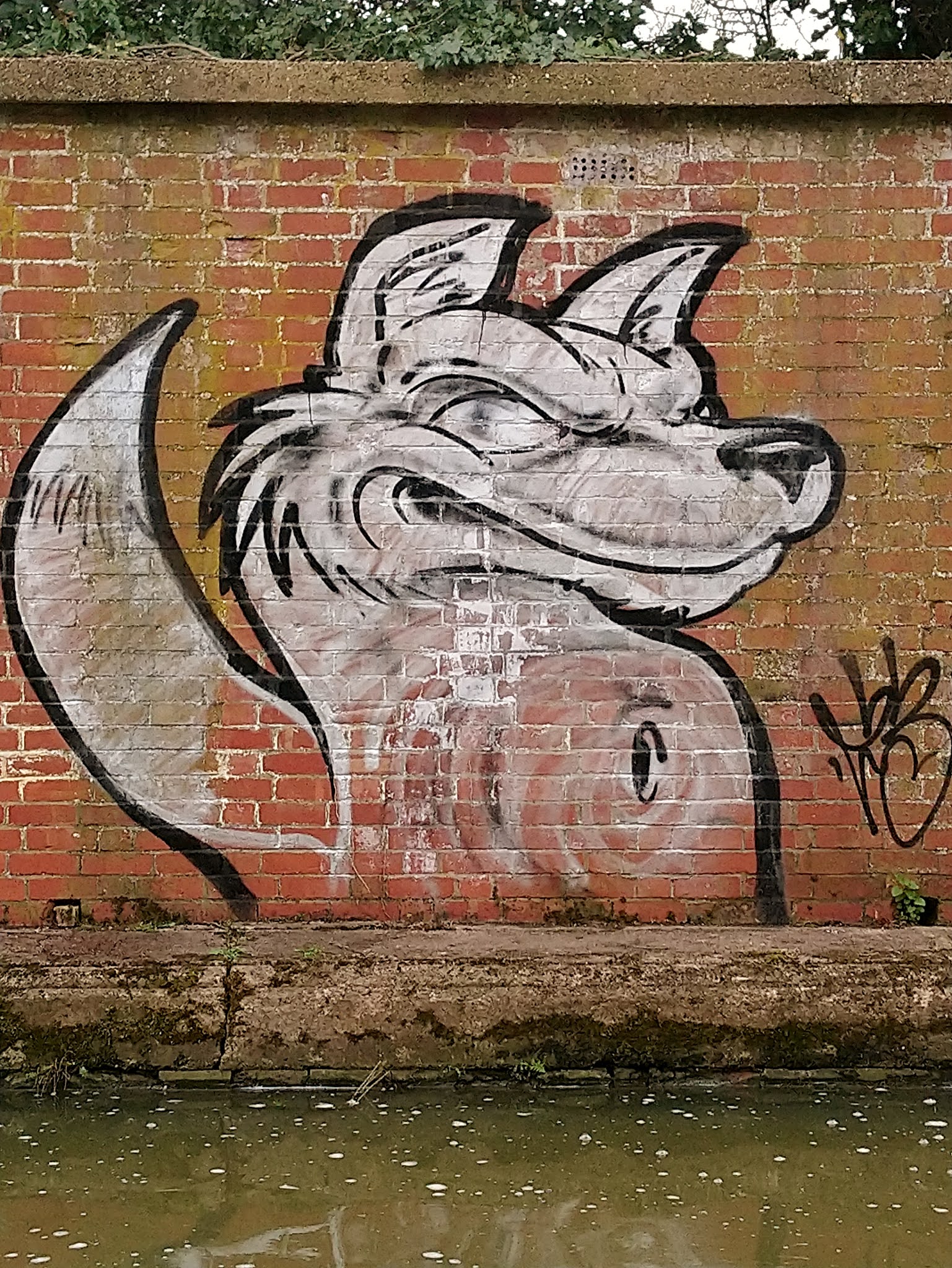
Tuesday 30 March 2021

Long Buckby, Whilton, Brockhall & Grand Union Canal Walk


Long Buckby Castle


We are starting off today at Long Buckby out towards Daventry in Northamptoshire. I have been doing one or two more local walks of late and have covered these off in previous write ups so its good to venture into pastures new as they say. The Castle ring-work is known locally as The Mounts,  and lies in the centre of the village. It was a bit tricky to find actually. Archaeological evidence suggests that it was built by 1150 AD. Many
Many Norman castles were built of earth and wood and were defended by a timber wall built on an earth bank surrounded by a ditch or moat. It is officially a ring motte with at least one bailey, and perhaps originally two.


We are walking in a clockwise direction today. The route takes us over the railway bridge across fields towards the village of Whilton. It is listed in The Domesday Book of 1068 under the name 'Wiltone'. The Parish Church of St Andrew is constructed from the local Northamptonshire Ironstone and was built between the 12th and 13th centuries. Little remains of the original, having been restored in late 18th century 

We spend a bit of time looking around the churchyard. Outside there is a memorial to Captain Harry Reynolds VC MC.Harry was a Whilton man, whose bravery and character during World War I brought him to the attention of the nation.

We pick up the footpath that crosses the Little Brington Road towards Brockhall.   


Brockhall, like many estate villages, is a small settlement that has developed around its eponymous hall. The village - Brocole in Old English, which means Badgers Hill - was recorded in the Domesday Book. There are some lovely old buildings, full of character and it is a charming little hamlet. 


Medieval gatehouse, Muscott

We pass through the lost village of Muscott just to the north-west of the village of Brockhall, although the two places are identified as separate settlements.The site consists of the earthwork remains of the deserted medieval village and of a double moated site, the location of the Muscott medieval manor house. The gatehouse to the present Muscott House is considered to be late medieval in date with 19th-century additions and is listed Grade II.

We cross over the busy M1 and drop down on to the Grand Union Canal running alongside the M1.


Whilton Marina

We follow the canal along it's path up to Whilton Marina. A flight of seven locks that are also referred to as Buckby Lock Flight.The locks are numbered from 7 at the top of the flight to 13 at the bottom. To the south of the flight is a long level pound, which stretches 14.6 miles (23.5 km) to the Stoke Bruerne Canal Museum.


As always there is some interesting artwork on display along the canal. Some better than others lets just say. Being a Fox lover I particularly like the one pictured above with the sinister face around the corner. We continue up to Long Buckby Wharf as far as the New Inn. We then cross over the A5  followed by the bridge over the railway line and the M1. We follow the footpath past Greenhill Farm towards Hoborough Hill. From there we are almost back to the starting point and it is a matter of finding where we left the cars!


Looking back


It has once again been a cracking walk , a bit breezy at times but generally good walking conditions. In total the distance covered was a fraction over 11 miles.


Thursday 18 March 2021

Wollaston, Podington and Farndish Walk (3 Shires Way)


The Roman Road

We are starting out from a windy Wollaston today, rain promised later so best get cracking. We are walking in an anti-clockwise direction today We soon arrive at a 'Roman Road' according to the map. It's a very muddy path to say the least. 

We follow the Roman Road until it meets up with the 'Three Shires Way'. A bridleway running through quiet rural landscape and remnants of ancient woodland. Linking with the Swan's Way at the start, it takes in the county boundaries of Bucks, Beds and Northants. A circuit of Grafham Water has now been added to make a total distance of 49 miles.

We pass 'Dungee Wood' on our right which is closely followed by 'Forty Acre Wood'. We make a small detour through the wood as the map shows a lake and a moat! The path was even more muddier than anything we had encountered previously. Also there was no sign of the lake or indeed a moat...It took a bit of clambering over a ditch and up a steep overgrown bank to even see the water. In truth it was a bit of a disappointment as it was essentially a simple fishing lake for Anglers. I stumbled back to find that my walking partner had just seen a Muntjac Deer run out in front of him.The startled Deer then ran straight into a fence in it's confusion to escape.   

We have now crossed the border into Bedfordshire, on the site of the former airfield at Podington. Podington airfield was originally built between 1940 and 1941 to accommodate two RAF  bomber squadrons. On 18 April 1942 it was made available to the United States Air Forces 8th Air Force. The first USAAF unit to use Podington was the 28th Troop Carrier Squadron in June 1942.The USAAF returned Podington to the RAF in July 1945 and the airfield was retained by the Air Ministry for storage. There are still some reminders of it's history. But sadly it seems to be a dumping ground for all sorts of rubbish which is a great shame.


Old Nissen hut on the former airfield

Still on the site of the old airbase we come to Santa Pod Raceway.The airfield was finally broken up in 1961 and sold to private investors. 

However before all the airfield was ground into aggregate, a group of drag-racing enthusiasts approached the owners to use the main runway as a drag racing strip. In 1964 an agreement was reached for what became 'Santa Pod'. In 1972 the concrete was re-surfaced with asphalt and a major European centre for Drag Racing was created. The straight track is used for 1/4 and 1/8 mile racing. 

Santa Pod is the venue at which the current world drag racing record, a time of 3.58 seconds at 386.26 mph (621.61 km/h) was set in July 1984. Santa Pod for many years remained the fastest all-asphalt drag-strip in the world since most North American tracks are partially or entirely concrete in construction.


As you might imagine, it is extremely open and the wind has got up and become a bit chilly. We continue on the footpath going past Great Hayes Wood on our left. We are going in the direction of the railway line. Having been through a wind farm we are now surrounded by solar panels. Something we see more and more of while out walking. They do seem to be a missed opportunity to utilise better for wild life or wild flowers. 
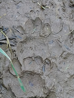
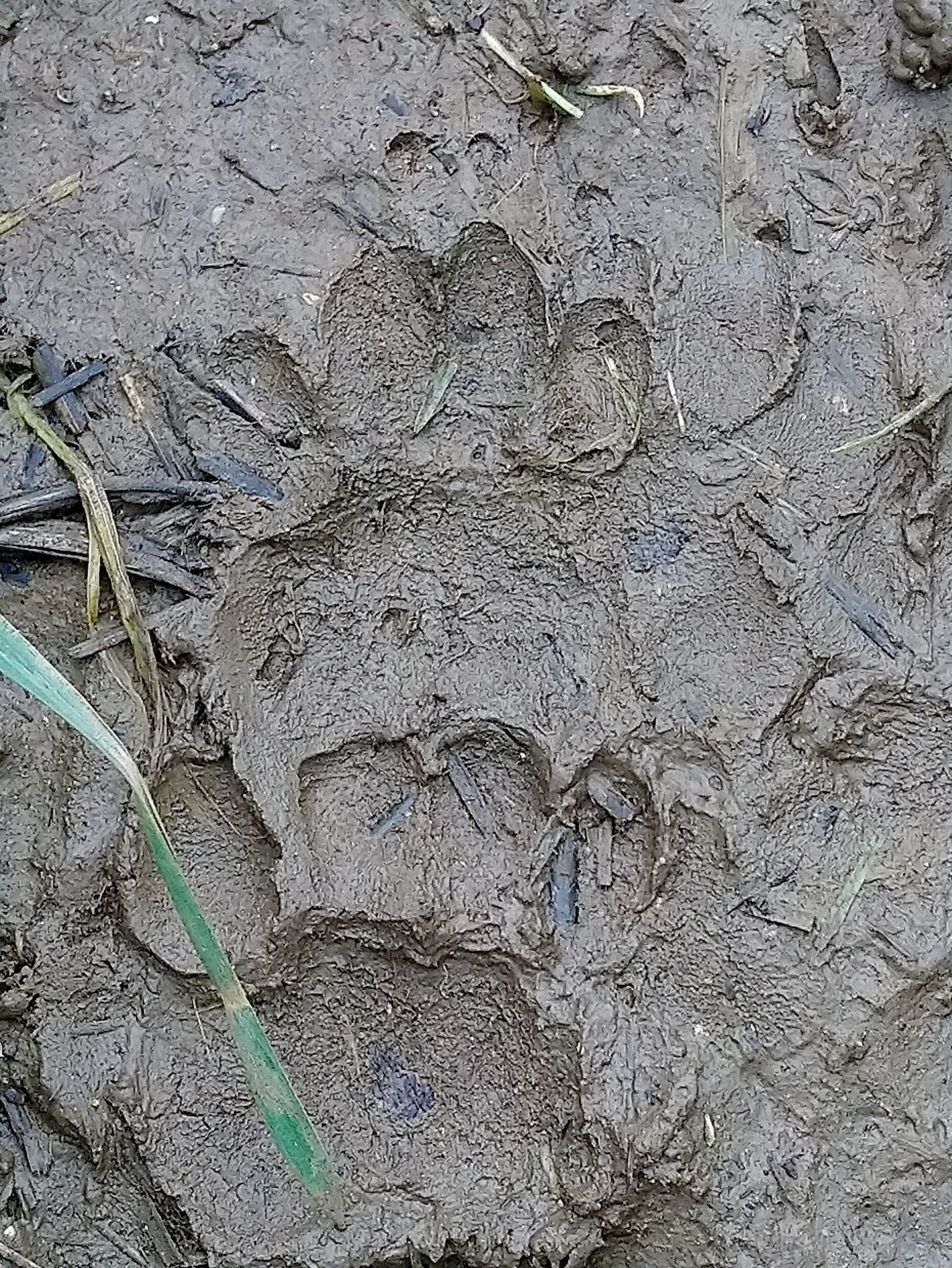
Badger Paw print

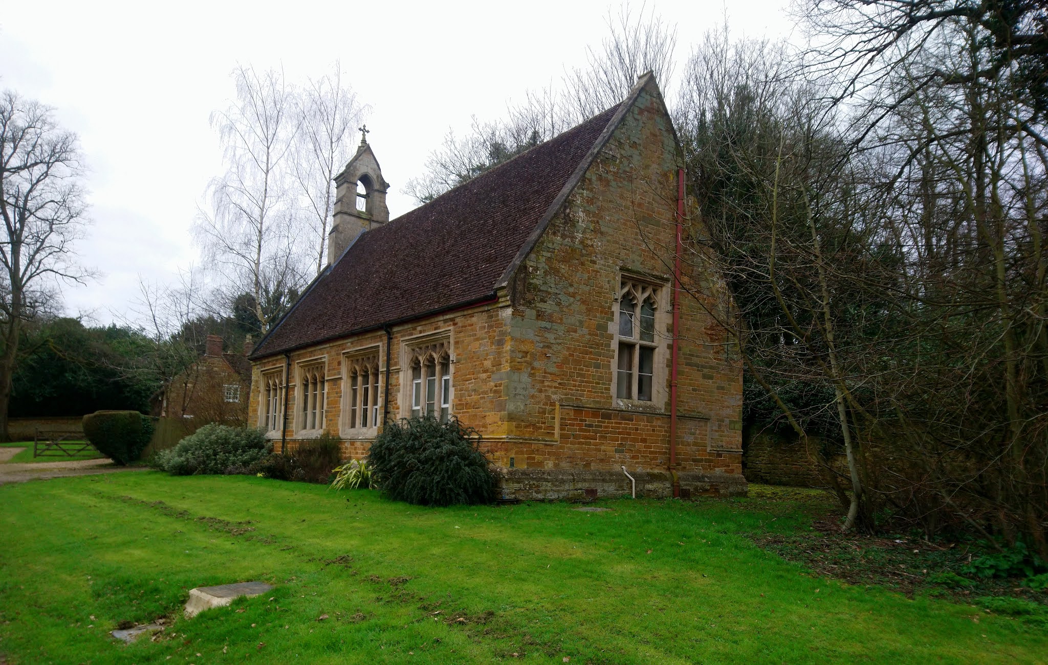
Little bridge over a stream


Our path veers to the left and we are heading towards the village of Podington. The map shows that we are passing by a 'motte and Baileys'. Some kind of mound and structure, usually a castle or fortification of some kind.There is a lot of evidence of Badgers, some big setts on the banks. There are also some very distinguished 'Badger runs' in the fields. They probably make the same trip every night and create their own well worn paths.

Podington is a small picturesque rural village; many of its buildings are stone cottages dating from the 18th century, and some even earlier. It has a nice garden centre too. We weave through the village and pick up the path that will take us to the rural hamlet of Farndish. The name Farndish means fern-clad pasture. It is home now to Saxby's Cider Farm since 2011.Many of the apples are grown in their own orchards.The family used to have a business selling pork pies The business traded for over 100 years but sadly closed in 2008. I recall always having a Saxby's pork pie in the fridge at the weekend as I was growing up.

 They still keep the pig logo as a memento to those days which is a nice nod to the past. No cider today though unfortunately and onwards we go. It has now started to rain as approach the last and bleakest part of the walk. An uphill climb all the way across fields to the B569 and past the school, back to the start point in Wollaston. A cracking little walk, coming in at just over 11 miles.  


Thursday 11 March 2021

Church Brampton, Holdenby and Lower Harlestone Walk

This particular walk was never really intended to be recorded on the blog. What started out as just a gentle leg stretching exercise turned into a full blown walk. After the 28 mile bike ride of the previous day some gentle exercise was definitely needed.  

The walk was so enjoyable and uplifting that I feel compelled to write a few words about it!

It started off in the village of Church Brampton , just behind the church. I walked up the short incline passing the Riding Stables to pick up the footpath. that leads up towards Brampton Hill. Somewhere I have walked recently on the Brixworth and Chapel Brampton Walk. Here the footpath snakes off in three directions. I take the first option before turning right again towards Sanders Covert on my right hand side. 


The path continues to 'Cank Farm' where there is a right of way between the buildings. Continuing on uphill there is then a long path that leads across fields to the village of Holdenby. Famous of course for having the Church that lost its village. I'm sure I've written in more detail about that in a previous blog. From Holdenby I wanted to find a different route that I have used in two previous walks in that area. This involved turning left rather than continuing down towards the church. A gated footpath took me across a field down a lane towards Coneybury Hill. This then took me past Holdenby South Lodge. 

The path to Holdenby

The Old School in Holdenby


The lane continues downhill until it finally crosses a free flowing stream. An uphill stretch then to a railway bridge which leads to Glebe Farm. It is just a case of following the bridleway past the buildings on the left and up to the A428 again.

The footpath continues directly on the other side of the road onto the Golf Course at Harlestone. I actually found 13 golf balls in very good condition on this stretch. Some were standing proud on the Fairway like mushrooms. They soon went in the pocket I can tell you. I was also grateful for bringing the binoculars as I also saw a Muntjac Deer too. 

The path continued past the Church and school winding round another stream. The path then lead up to a large lake by the Golf Course. i remember walking around here many years ago when I lived in Duston.It is a beautiful sight, particularly on a sunny day. There is then a wooded area that was already smelling strongly of wild garlic. 


The are some hills and hollows too, some sort of earthworks probably. Once again you guessed it I have to cross the A428.Taking the bridleway located just past the Fox and Hounds pub in Lower Harlestone. This takes me as far as the railway line and into Fox covert.

There are two paths in the covert and I went left which was slightly the longer. The left hand route would have taken me directly towards the club house and the exit. Instead I had to navigate myself across various fairways. It didn't matter too much as the course was deserted anyway with the Covid restrictions. 

I emerged eventually in the lane that runs between the course and the driving range. It was just a case then of following this lane (Golf Lane) back to the main road. There were some stunning properties situated here. Some were absolute mansions.

Crossing the road and the short passage took me back to the car. It was a fantastic walk and came in at around 8.5 miles. I messed up the data recording  and chopped off the last mile or so..


Tuesday 9 March 2021

East Haddon and Great Brington Walk

A fresh start but not windy which is always a good thing. This walk actually takes in a good part of two other walks that have been documented on this blog previously. There is the East Haddon and Holdenby walk (October 29th 2020) and The Great Brington and Althorp walk ( November 11th 2020).

Therefore I wont be going into too much detail about the start of the walk from East Haddon as it follows he same route. Instead of cutting back to EH we continued on to the A428 crossing. Then making the ascent uphill into the village of Great Brington..

The route then mirrors the start of the Great Brington and Althorp walk that leads back to the centre of the village. It was nice to see the first Spring lambs of the year. Plenty of Snowdrops out as well and lots of bird activity readying themselves for nesting in the hedgerows.  

Instead of heading towards Althorp we picked up the footpath that went to Thornburrow Hill and the Glebe Farm. It's a steady uphill climb but not too bad.There is evidence of Badgers,a lot of fresh diffing and clearing out the debris from the Setts.

The path leads us to the railway line, we  cross going under Patford Bridge. We are now on the road that leads to Long Buckby. We are going in the opposite direction though today. After a short saunter along the road we pick up the footpath that takes us past East Haddon Hill and Garretts Barn on our right hand side. There is another group of walkers out, the first we have seen today.  


Badger Setts

 In truth it is not a particularly memorable path. But we are outside in the fresh air and getting some exercise at least.

There have been an awful lot of Yellowhammers in the hedgerows. Very easy to spot with their yellow plumage and white tail feathers in flight.

There are plenty of people who have hardly left the house in the last year. We emerge near the crossroads of the A428 and head towards the village. We take a detour across some fields on the left hand side. It's a bit confusing as the path deviates in different directions. It leads us into the lane very close to where the car is parked near the church.

Although nothing particularly spectacular it has been a decent walk. Slightly longer than some of the other ones of late  coming in at just over 10 miles. 


Monday 1 March 2021

Chapel Brampton and Brixworth figure of Eight walk


We are starting at the Car park of the Brampton Halt Public House, on the Brampton Valley Way. The 14-mile rail trail built on the way of the former Northampton to Market Harborough Railway in Northamptonshire. The actual railway line closed down in 1981. 

The route itself will be a figure of eight of sorts and the options are still open as to which way we will go as we set off. The only certainty is that we are heading northwards towards Brixworth. 

We have to cross a couple of bridges early on before proceeding on the gravel pathway.There are quite a few people out and about on what is a very pleasant sunny late February morning. Not surprising really as the old railway line is a haven for walkers and cyclists alike. 

We continue as far as the main road that goes between Spratton and Brixworth. We take the right footpath that climbs gradually up to the Church. Surprisingly I have never walked this particular path before. There are though some stunning views back across the valley . Even more impressive today with the blue skies and fluffy slow moving white clouds.  


All Saints Church Brixworth is a wonderful example of Anglo-Saxon architecture. It is the largest English church that remains substantially as it was in the Anglo-Saxon era. 

The church dates back to the 7th Century and a Spire was added in the 14th Century. The West Tower has a ring of six bells dating from 1622 with the most recent being cast in 1993. As is the case with most things at the moment all services are being carried out online during to the Covid virus outbreak.  


 Leaving the Churchyard via a stile we head back through the village of Brixworth .One thing you can't fail to notice in Brixworth is the number of blue plaques mounted on thirty buildings in the village. The Brixworth History Society have created a heritage trail that can be followed right through the village. 

The one in the picture is from 'The Old Chapel' and dates back to 1811. The last recorded baptism was in 1972.

We cut across the busy A508 (Market Harborough Road) and we are on the Edge of Pitsford Reservoir . Although it seems to be more popularly know as Brixworth Country Park these days. 

It is even busier around here, at the first sight of decent weather the locals all seem to head for the most obvious of places.The more remote and obscure the better in my book.   

It is a brief visit to the reservoir and we exit towards the excellent cricket ground of Brixworth C.C.C. A short climb uphill and then we turn left down 'Merry Tom Lane. This path will eventually cut across the Brampton Valley Way. I have been down here before on the Mountain Bike. Talking of bikes a lady is struggling up the incline, little wonder with her young  daughter strapped into the passenger seat!


It's a lovely footpath that links up from off Merry Tom Lane to the Welford Road. There is also a nice little footbridge which is always good to see. Once again this a path that I must have driven past hundreds of times and never knew existed. We do a slight extension to the original map here, taking in the small triangle next to Brampton Hill. It is then just a matter of taking the footpath back into Chapel Brampton. There is one more surprise left as we cut through a small 'pocket park' and discover another footbridge and a little weir. A great walk at just over 10 miles and even saw my first two butterflies of the year.


Mr Punch - The Musician Leicester

I've just passed a late fitness test and have made it to 'The Musician' in Leicester. Just hoping that my knee will take the str...