Sunday, 25 April 2021

Old, Faxton and Scaldwell Walk (Short version)


This is a shortened version of a walk that I did in December 2020. On that occasion conditions were awful! Mud, mud and more mud made the walking very difficult indeed. 

Thankfully today conditions are totally the opposite and near perfect. Starting point is the lovely village of Old, just north of Pitsford Reservoir. 

We head off on the footpath in the rough direction of Mawsley village. We pass through the strangely named 'Old Poor's Gorse' and emerge on the road. I bump into a couple of old work colleagues and have one of those embarrassing moments when you can't remember their names. Even worse they both remembered mine .....

A short wander along the road and we pick up the next footpath that will take us across fields in the direction of Faxton.


Faxton as I have mentioned in previous posts is a deserted village.

Former residents have recalled that Faxton could only be reached by horse-drawn vehicles, as none of the roads leading to it were made up to accommodate motor vehicles; they considered that to be a major factor in the decline of the village. This contradicts other theories that it was the plague that decimated the village. There is very little to be seen these days sadly, just some old gravestones dating back over 200 years. There is also a marker to indicate where the Church alter would once have been. 


There are paths going off in all sorts of directions. We pick up the one hopefully that will take us towards our next village 'Scaldwell'.  A very small village with no pubs or shops, but there is a church! Scaldwell has a church dedicated to Saints Peter and Paul. It has a Norman tower and some 13th century-features and was restored in 1863. We walk up the road into the village and find the footpath that will take us past a farm and eventually back to Old.


There are plenty of stiles to negotiate on this the last leg of the walk. Once we are past the farm there is a stile that seems to take us in the wrong direction. A bit of fence climbing is then required to get us back on track. 

There are plenty of sheep in the fields that we have to cross.Some of which are very protective to their lambs of course. We give them plenty of room and there is no problem at all. 

Crossing the final style and we are back in the village of Old. It has been a cracking medium range walk coming in at exactly 7.5 miles.   

The previous walk can be found at 

http://peterja-storytellersnight.blogspot.com/2020/12/old-faxton-and-scaldwell-walk.html


Everdon wander


A couple of short blog entries coming up. In fact this little walk at Everdon was never intended to be written up at all. We were just going over to see the Bluebells at Everdon Stubbs. Unfortunately we were a week or two early and not many were in bloom. 

We continued into the lovely village of Everdon as it was such a pleasant Spring day. Sadly 'The Plough'  Public House was not open, or indeed the Village Hall where we have had cream teas in the past. Very much a sign of the times......

We continue through the village past the Church and the Field Studies Centre on the road to Fawsley. There should be a footpath somewhere near the bend that will take us off the road. Thankfully I manage to find it after originally walking past it. There are some beautiful views across the fields from our elevated position. We pass Everdon Hill Farm and then Westcombe Farm on our left. 


We could continue on to Fawsley but this will keep for another day. Particularly as there is a steep hill (Temple Hill) the other side of the road. 

We are very tempted to continue down the road to the village of Preston Capes. Instead we pick up the road back to Everdon. It's very quiet with little traffic to worry about. We have parked at the top of the hill by the 'Stubbs' so it is a long and winding not to mention steep climb. The views to our right make it all the more enjoyable.


Looking back towards Everdon


Wednesday, 21 April 2021

The Shakespeare's Avon Way - Hillmorton, Clifton Upon Dunsmore (4)


Hillmorton is our starting point on the next leg of the Shakespeare's Avon Way. Not quite picking up from where we left off last time but the intended route will be the same at least. 

We are parked up in the Church of St John the Baptist Car Park. I did make a donation to church funds to show our gratitude. The church of St.John the Baptist in lower Hillmorton is the oldest building in the locality with the oldest parts dating from the13th Century.

We are right on the Oxford canal but decide to walk in an anti-clockwise direction, leaving the canal stretch until last. We will head out towards Lilbourne starting with what looks on paper the least interesting part of the walk. 

It's a lovely clear and sunny day once again just perfect for walking. 


Church of St John the Baptist Hillmorton

Old Radio Mast anchor point


To the east of Hillmorton is the former site of the once famous Radio masts that were opened in opened in 1926, and contained radio masts 820-ft (294 metres) high. For many years this was a major landmark. Coming down the motorway you would always know when nearing home when the masts came into view. All that remains now are the large wedge shaped concrete anchor points that once secured them. The last of the masts came down in 2007 and now a housing estate is being built.


All Saints Church Lilbourne


Arriving in Lilbourne we first pass the War memorial and then the Head of Steam Public House.The Head of Steam became Lilbourne's only pub since 'The Bell'  closed it's doors some 15 years previous and been converted into a private residence. The villages name means 'Lilla's stream'.


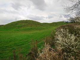
Another Motte & Bailey and view back


As we climb the hill away from Lilbourne we find another 'Motte & Bailey'. The monument at Lilbourne Gorse is one of two closely associated motte and bailey castles which lie within 800m of each other. Both the motte and the bailey are essentially undisturbed and survive in good condition. The motte and bailey stands in an isolated position on high ground, looking towards Watling Street to the west. 


Dow Bridge


Dow Bridge is where the A5 Watling Street crosses the River Avon. We make a slight detour to take a closer look. This involves  quite a bit of clambering and climbing through brambles. It is the point where the three counties of Northamptonshire, Warwickshire and Leicestershire all meet, forming a tripoint. A bridge has existed here since Roman times. It consists of five brick arches, with stone quoins.Built to carry foot passengers and horses. The bridge was rebuilt in around 1776 and again in 1838. It is now disused having been replaced by a modern road bridge to the west which was built in the 1930s

St Mary's Church


Having survived Dow Bridge with only minor abrasions we arrive in the village of Clifton-Upon- Dunsmore. The most easterly village in Warwickshire and West Midlands for that matter. 

We pass the church and a lovely looking pub called 'The Bull.Originally a farmhouse, and according to a plaque on the entrance it was built in 1598 and became a public house in 1825. There were rooms for travellers and stables for their horses, some evidence of which still survives. We pass under a railway bridge and are then back on the canal.


We are on the Oxford Canal, a 78-mile (126 km) narrow canal completed in 1790. it connects to the River Thames at Oxford and is integrated with the Grand Union Canal. 

Oxford Canal

There is the odd walker and a few cyclists but generally pretty quiet. We hear Church music coming from a narrow boat and it is obviously the funeral of the Duke of Edinburgh that they are watching. We continue following the canal back to our starting point at Hillmorton.

Bridges new and old
 

It has been another great walk taking in the SAW. In total 9.75 covered! 


Monday, 12 April 2021

The Shakespeare's Avon Way - Clay Coton (3)

Good to be back on the 'Shakespeare's Avon Way' footpath once again. Starting point is exactly where we  left off last time in the lovely village of Clay Coton. Conditions are much better too! Last time we were here the road was flooded and the fields were a muddy nightmare.

Quite a short walk today as the footpaths are a bit limited for a circular walk. Probably fair to say that expectations are not altogether high. However sometimes it is the ones that you least suspect that throw up the most interest. 

The footpath leads us past the wonderful former Church of St Andrew that ceased services in the 1950's. It then became derelict and was even threatened with demolition. It stayed fenced off for around 30 years all boarded up. Rescue finally came in the early 2000's when it was converted to a private home.   


Former Church of St Andrew

The Church is a 14th Century building much restored by the Victorians. The nave was rebuilt in 1866 but the west tower and the short spire are original. 

Sadly much of the medieval wooden carvings were stolen during the years of abandonment.

As we walk towards Lilbourne there is a signpost for 'Greenhaven Woodland Burial Ground'. It opened in 1994 and was the first privately owned natural burial ground in the country. The site originally catered for approximately 7,000 plots. It is hoped that the site will be completely wooded by 2060 and passed over to a wildlife trust who will maintain it as a natural ecosystem.

Further on we find a dead lamb that has probably perished in the overnight cold weather. It is stamped with the number 13 which has proved unlucky for this poor creature....


Motte and Bailey

Just outside of Lilbourne we get our first glimpse of the River Avon. We have walked past the local church, All Saints, which is Grade I listed building dating from the 12th century. 

There are also the remains of a Norman 'motte and bailey' castle.(A fortification with a wooden or stone keep situated on a raised area of ground called a motte, accompanied by a walled courtyard, or bailey, surrounded by a protective ditch. It is always a moment of excitement to come across one of these.Windsor Castle in England, is an example of a motte-and-bailey castle.

 We pick up the next footpath that takes us uphill to the village of Catthorpe.

Catthorpe gives its name to the nearby Catthorpe Interchange  road junction formed by the M1 and M6  motorways and the A14 road. So it can get pretty noisy around these parts.

If we had carried on we would have ended up on the M6 so we detour across a large field. The field is only notable for the remains of a tree in the centre. There are numerous rabbit warrens that look pretty active judging by the amount of droppings around the base. Also a lot of the bark has been removed, possibly a Badger or Deer?

The path leads downhill to Catthorpe Manor, there seems to be an outdoor wedding venue within the grounds too. Down towards the pond we make a sad discovery by one of the trees. On closer inspection it transpires that it is  Red Kite. It is perfectly intact with no signs of injury. Even the eyes have not yet been pecked out by the local crows. Hopefully it hasn't been poisoned and maybe died of hunger or the cold? I am starting to feel a bit like the 'Grim Reaper' today with all the death references....


Red Kite

It's a sad sight to see this most majestic of birds cut down in its prime. It is the first time that I have had the privilege of seeing a Red Kite at such close quarters and they really are a special bird of prey. 

Thankfully following a reintroduction projects Red Kites are no longer endangered and are now a regular sight , particularly around Northamptonshire.

We leave the grounds of the Manor and pass under the motorway bridge. Following the footpath that then takes us alongside the A14. 

Despite the busy road networks there is still an amazing abundance of wildlife, meadows, streams and open spaces. The path gradually pulls away from the A14 and we are heading back towards Clay Coton. 

The church at our starting point comes into view and we are almost back. It really has been a cracking walk, not what we were expecting at all. 

In total a total distance of 7.16 miles.   


Sunday, 11 April 2021

Quinton, Piddington, Horton and Hackleton circular Walk


Starting point today is St John the Baptist Church in the the village of Quinton. It is based on the route listed on the Northamptonshire Walks website. I tend to go off on a tangent and more often than not get a bit lost too. 

The footpath is just out of the village and runs parallels to the road. It is very quiet until out of nowhere an errant dog comes charging over and jumping up at me. Thankfully the walking trousers are not clean on today. I manage to get hold of the lead and hand the energetic hound back to a grateful owner. At the T junction I follow the path towards Park Farm.  

It didn't take me long to get off the marked track, however I was able to pick up the Midshires Way and correct myself. In the distance I could see the Church at Piddington so I kept heading East. 

Eventually the path passes through a farm and then exits into a lane in the village of Piddington. There seems to be a tank parked in the drive of one of the houses. Not something you tend to see on a walk really. The lane winds down to the village pub ' The Spread Eagle'. Not a place I have fond memories of ... Almost opposite is the bridleway.


 This part of the walk is very exposed, thankfully the weather although chilly is dry. This is actually part of the Northampton Round Footpath.You can't go far wrong her and the path takes you into the next port of call 'Horton'. On the bend I spot my old nemesis the Police 'Speed camera van'. It was this very spot some years ago that I was trapped. Yes I still feel bitter about it to this day! A bit of walking on the path now rounding the bend towards Brafield. the next Bridleway is located on the left hand side.


It's a lovely open stretch of countryside once again, very peaceful with nobody else about. The only noise is from the Skylarks who are in good voice overhead. 

The exit lies in the corner and a nice little stile/bridge which is re-assuring to find. I have now arrived in the next village 'Hackleton'. The path is a little tricky to find as it is over the road and runs between houses and the Village Hall. 

The path winds it's way back up to 'Piddington' and emerges into a housing area. Just out of the close I can see the Church and the next part of the walk. But the priority is a spot of lunch and a drink both of which I have brought with me. 

Suitably refreshed I continue past the splendid looking  Parish Church of St John the Baptist.Built in about 1290, although it is believed that there may have been a place of worship on this site prior to that date. There are some wonderful barn conversions here too, I complimented one gentleman on his beautifully maintained garden. He seemed to appreciate the encouragement from a fellow gardener.  
 

The tower rising to a spire was rebuilt following a rate levy in the Parish in 1847 and on the east face of the tower is the church clock, more than a 100 years old, believed to have been made by Dent and Co., who manufactured "Big Ben" From here there is access to a number of country paths to explore.


This is my favourite part of the walk, the countryside is beautiful with the yellow of the oil seed rape just coming out.

Thankfully the paths are very well marked for the majority of the walk. A lot of it depends on the Farmer as to well they are defined. To me it makes sense to clearly establish the footpaths so that responsible walkers can keep to them. The path eventually takes me back to the path that I picked up after leaving Quinton at the start.

It has been a cracking little walk and comes in at exactly 8.4miles. Probably a shade more than if I hadn't gone wrong early on in the walk.


The John Bunyan Trail (3) Hexton to Shillington

It's one of those 'shall we, shan't we sort of days. The weather has been poor all week and has worsened with the arrival of Sto...