Thursday, 24 September 2020

Braunston and Ashby St Ledgers Walk


Another sunny warm September walk, we really are being spoiled with the weather at the moment. Bit of a historical route lined up today.

However we start off on the canal , seem to have spent a lot of time by the water one way or another this last few months.   


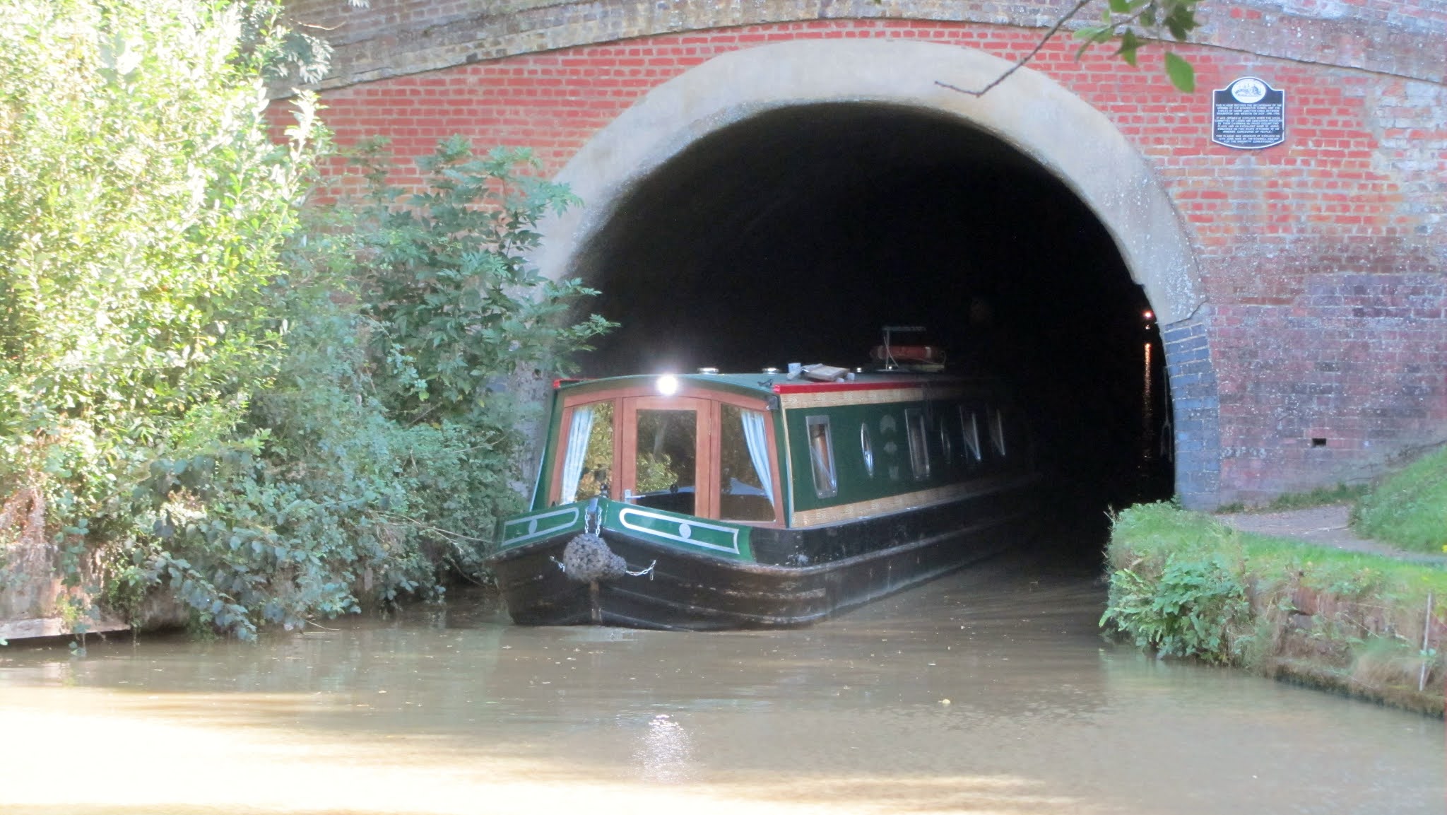
We walk towards the Braunston Tunnel, just in time to see a Narrow-boat emerge. Braunston Tunnel is 2,042 yards (1,867 m) in length with no towpath.It was opened in 1796 and has three air shafts along the length. 

The plaque on the wall marks the opening of the tunnel. 


Bawdy boat name !

We continue canalside until we reach Braunston locks and then the Marina. The canalside pub 'The Admiral Nelson seems to be doing a good trade at least!

The marina lies at the crossroads of the Grand Union and Oxford canals, and indeed of the whole waterways.
Canal Airshaft

We cross over the bridge at the Marina and head towards the village of  Ashby St Ledgers (Jurassic Way).  Our first port of call is at The Olde Coach House Inn. A nice pint of Tribute Cornish Pale Ale goes down well.  Suitably refreshed we continue into the village. 

There are some beautiful thatched cottages in the village. I liked this quirky looking house in particular. It's clock tower was very striking (no pun intended) . The large horses heads on the gateposts are interesting too, maybe a veiled warning ? 

Mentioned in the Domesday book 'Ascebi' (ash tree settlement)The population of 173 (last census 2011) are keeping a low profile and it is eerily quiet. 


We keep walking straight through the village towards the church of St Leodegarius.  Looking to our left there really is some famous history to be seen! 


The Manor

It is said that the room above is where the Gunpowder plot was hatched. The Gunpowder Plot was a failed attempt to blow up England’s King James I (1566-1625) and the Parliament on November 5, 1605. The plot was organized by Robert Catesby (c.1572-1605) in an effort to end the persecution of Roman Catholics by the English government. Catesby and others hoped to replace the country’s Protestant government with Catholic leadership.

Church of St Leodegarius.
The manor was passed down the male family line to Robert Catesby.

The manor's central location was convenient to the houses of the Catesbys' many friends and relations, which supposedly made Ashby St Ledgers a type of 'Command Centre' during the planning of the Gunpowder plot.  In the room above the Gatehouse, with its privacy from the main house and clear view of the surrounding area, Robert Catesby, his servant Thomas Bates and the other conspirators are said to have planned a great deal of the Gunpowder Plot.


We leave the village passing the Old Dairy, the sign shows that it is still owned by the Crown. The Crown Estate purchased the Ashby St. Ledgers estate in October 2005. 

At the junction we take the path that is in the direction of Welton. It's a nice part of the walk across several fields although there is quite a steep uphill finish as you approach the village.

A nice little walk at just over 7 miles.


St Martins Church Welton


Saturday, 19 September 2020

Woburn Walk


                            St Mary's Church Gargoyles

Today's walk I am told is going to be a little different ! We are off to a good start at least, ample free parking opposite St Mary's Church. Some friendly looking Gargoyles are smiling down on us from the church tower, on what is a pleasant sunny morning. We turn left along George Street leaving the lovely town centre behind us. 


The  route guide that we were using said that the walk was 8 miles. However a friend who completed it  recently came in at 11.7 miles. So we shall see ? We continue walking along the perimeter wall of what must be Woburn Abbey.We reach the entrance to the Deer Park at Ivy Lodge.   

We are now officially on the Woburn estate! As long as we stay the 'right' side of the yellow marker posts and don't deviate. Set within 3,000 acres of Deer Park, home to nine free roaming species of deer.The Red Deer and the Roe Deer are most prominent.include the Milu, or Pére David's Deer. Sika, Axis and Barasingha, and the rare and shy Rusa Deer. We might also see small Muntjac and Chinese Water Deer roaming freely.

I did venture onto the bridge that takes you towards the driveway. The Park was landscaped in the 19th century by Humphrey Repton, and stayed largely unchanged. The magnificent ancient trees and ornamental ponds make for a spectacular vista.Near basin pond is a tree known as 'Abbots Oak' said to be where Abbot Robert Hobbes was hanged. All part of the dissolution of the monasteries under Henry VIII.

We exit the Park after passing a lover Tudor style building to our right. We meet six other walkers coming the opposite way. They know the route well and warn of how muddy the next part of the route becomes in the winter. But today it is fine and we make good progress through a mixture of woodland and open fields to the village of Eversholt.   The village name means 'wood of the Boar' be great to see one !


Blue plaque to Frank Wild
Eversholt Cricket Pitch

Eversholt is a pretty village with a Village Hall overlooking the cricket pitch. The village pub 'The Green Man' is just opening as we arrive. We stop for a break , a refreshing pint of Blackpit Ruby Ale 3.7% goes down well. Brewed on the North Bucks and South Northants border at Stowe. 

The pub is leased by former 'Bake off'' winner Candice Brown. 


The Domesday book of 1086 lists Hugh de Beauchamp as Lord of the Manor for Eversholt whose descendants owned property there until the 13th century when the land passed to Woburn Abbey.  

Entering the village I notice a blue plaque on the wall to Frank Wild 1873 - 1939. An English sailor and explorer.e participated in five expeditions to Antarctica during the Age of Antarctic Exploration. Originally from the North Ridings in Yorkshire his family moved to the area and was educated at Bedford. He was regarded as Shackleton's right hand man on the 'Endurance' that sailed to Antarctica in 1914. 

Leaving Eversholt we pick up the Woburn Road and go up a steep road in the direction of Froxfield. This takes us back into the Deer Park again. A few confused safari park drivers seem a bit lost and ask for directions.Taking a sharp right it's a case of following the marker posts again. We find a good place for our pic-nic. 

The path will again take us close to the perimeter fence of the park.


Safari Park in the distance


Right against the fence was a Black Bear ! Quite a way from the circling cars of the visitors. In the far distance there are Elephants. I try and get a closer look while avoiding the CCTV cameras scattered around.I'm so focused on the horizon I don't see the huge pair of antlers rising out of the ferns....


A huge Deer is just a few yards ahead , I don't want to upset it so back away very cautiously. 

Following the path we go over a cattle grid and exit the Deer Park . We turn left through a lovely wooded area . Lots of interesting Fungi around at this time of the year as we move into Autumn. 

We exit the woods to the entrance of the safari park. A couple of inquisitive Zebras come for a closer look.

To the left is the entrance to the Safari Park so walk towards it & then turn right down the road past an old red Telephone Box. I notice that it is now £26.99 fee for an adult. Seems expensive , however the upkeep of the park must be colossal. 

Seems today we are going to see a lot of it for free.


There are two huge lion statues marking the entrance.First opened in 1970 as a means to help improve the financial position of the estate & restore the Abbey, which had fallen into disrepair.

The Safari Park itself covers 360 acres (150 ha).The park lets animals roam freely while visitors drive through their enclosures.


The path runs between the road you drive around the Safari Park on and the elephant (Asian) enclosure. Further behind two white Rhinos show some interest in the passing cars. We see various other animals including Giraffes, Ostrich and Bactrian Camels.  We leave through a gate into a shady wooded area, but still the animals can be seen. To our left is an enclosure with Wallabies of various shapes , size and colour. This is also the 'Go Ape' area where the public can have a treetop adventure on zip wires. 

Sadly we are nearing the park exit and arrive at the huge gates. There is nobody around and the gates seem to be locked.....This is not looking good. 

Fortunately despite their size there is a knack to opening them and with no small amount of relief we cross the main road and turn first left up Horsepool Lane.From here on it is largely fields all the way back to Woburn.


It's still lovely and warm and sunny and we finish off our picnic. 

The excitement hasn't quite finished as we have a bit of a run in with a log cutting vehicle that blocked the path. The operator it seemed didn't believe in stopping for walkers .Clearly no health and safety ethics....

Finally the path turns left to Birchmoor Green.


We pass through a small hamlet of houses on our right . One of which had this old fashioned washing wringer outside. A bit of local history as it originate from 'Gibson Andrews' of  Woburn.

Sadly as we near the end of the lane there is the horrible sight of fly tipping. It seems so prevalent now more than ever and is a complete eyesore.

It is something that blights our beautiful  countryside and completely disgraceful. If I had a pound for all the tyres I've seen dumped this Summer I would be a rich  man.


At the main road we turn left back in to Woburn and the re-assuring sight of my old friends the Gargoyles.

At the junction we turn left back into Park Street & to the car park where we started from. It's been a fantastic walk and according to my timing device 9.66 miles. I look forward to doing this walk again maybe late Autumn or Winter , who knows ?


 .


Saturday, 12 September 2020

Cider Making

Today's task is to convert the large supply of apples (pictured left) into a smooth golden brown liquid that will eventually become cider.

It is a mixture of different apple collected from various sources. As a general rule you  need in the region of 9 kg (20 lbs) of apples to produce 4.5 litres (1 gallon) of juice.
I definitely have several times that amount.

The ripest apples carry the best flavour and most juice.  I dont' think it matters too much if several of them are bruised and a bit brown , as long as they are not rotten.

Dessert apples are better , about 70% is ideal. Cooking apples provide the required acidity about 30%. You are looking for a pH reading in the region of 3.6 to 4.2 pH. I'm not that fussy as I've used a good quantity of cookers. We shall see !


Cidermaker's with 'Scratter'
One that didn't make the grade

 I've gone over to see an old friend of mine who has the all the gear needed, A pulper sometimes called a 'scratter' or  'Fruit crusher'. He also has a press to extract the juice.

I start to chop the apples as Simon starts to feed them through the pulper . It is actually a converted garden waste shredder. I quarter the apples,removing any bad bits. No need to be too fussy and the core and pips are fine.

When crushing, be careful not to over do it. The finished apples should have some substance to them, and liquid juice should not be present. If it is you have pulped them too much......


The Press
The crushed apples are then ready to be pressed.This will mean you only get the juice and you will leave all of the pulp behind.The pulp can the go on the compost heap or green bin.

From out of nowhere a few wasps have started to show a bit of interest. That's fines as long as long as they stick to the rotten and unwanted parts of the apples.

The press is turned down onto the fruit until you feel real tension. As soon as you do, don’t keep turning but leave this in position for a few minutes. You can see the juice start to run. When the juice stops then tighten again and leave.
The juice is captured in the large plastic bucket that is going to be used for the fermentation process.  

Once the last of the pulped apples have been pressed there is about 18 litres of juice collected.


It is at this stage that you can take a hydrometer reading of the juice. To do this, place the hydrometer in the juice and you will see a reading where the hydrometer is level with the liquid. You can then use this reading to work out how much alcohol will be present after fermentation.

To boost the gravity (strength) I will add a kilo of caster sugar. This will then turn to alcohol and make a stronger cider.
I will then leave to ferment at a temperature between 20-27°C for about 5 to 14 days or until the hydrometer is showing the fermentation has finished. A constant cool temperature is much better than one that fluctuates.

When the fermentation has finished (the gravity reading on the hydrometer will be the same for a few days and will be under 1000 SG) I will siphon/rack off into clean sterilised glass demijohn containers.

Friday, 11 September 2020

Walking The Ridgeway - Hackpen Hill, Winterbourne Monkton


Hackpen Hill
Amazingly our first venture onto The Ridgeway in 2020 ! This would most likely be the last as well, it being the last leg of the journey. It's a great pleasure to be out on this history laden path that has provided such a rich walking experience. We wouldn't need to go to the actual start/finish point as this had been covered on a previous visit to Avebury. So no Bunting or 21 gun salute to celebrate our achievement sadly.


Hackpen White Horse

Our starting point was right next to the chalk hill White Horse at Hackpen. On the edge of the Marlborough Downs 2 miles south east of Broad Hinton. One of nine white horse hill figures located in Wiltshire. Dating back to 1838 it is said to commemorate the coronation of Queen Victoria. The horse is 90 square feet (8.4 m2).
The expression "as different as chalk and cheese is sometimes believed to refer to the land divided by Hackpen Hill. The hill forms the boundary between the high chalk downs to the south of it and the clay cattle country to the north, where cheese is a product of the milk from the cattle. There is something quite fascinating about a White Horse carved in the hillside. There are apparently 17 white horse hill figures in England in total.

 It's the most perfect of days for a walk, a slight chill in the air as we start off. It quickly warms up and a layer or two of clothing is soon dispersed with. The views are spectacular, particularly to our right looking towards Avebury in the distance. We can even see the huge stones that line Kennet Avenue.   
There are a few other walkers and cyclists venturing out on what I would say is one of the most stunning parts of the whole Ridgeway.
There have been many highlights but for me this part of Wiltshire has some kind of mystic quality.
It is steeped in history and mystery that I can't get enough of . 

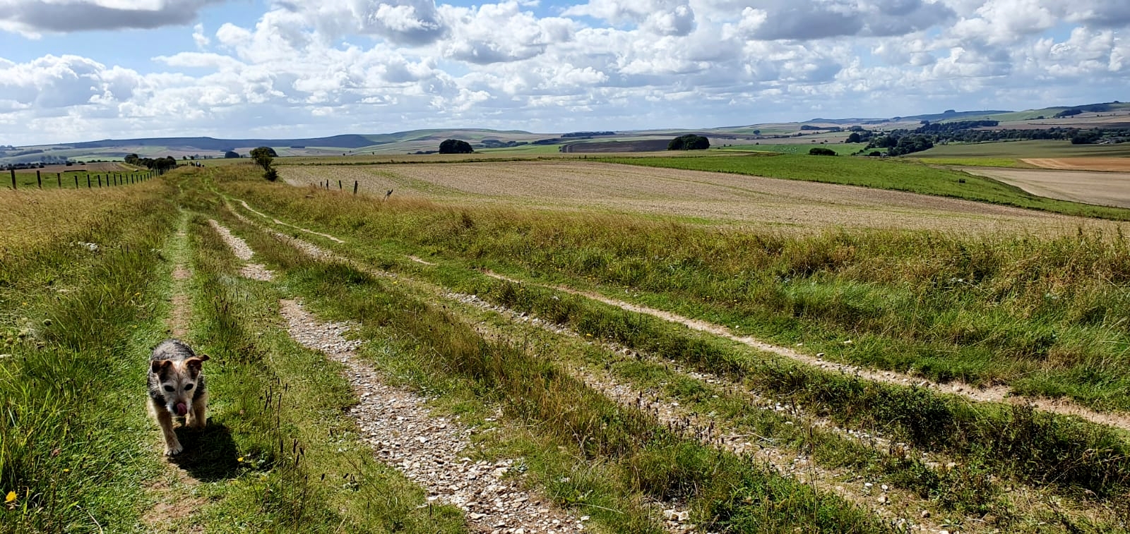
Little 'Archie' has walked every single step of The Ridgeway too, so great respect to him.
It is not surprising that the North Wessex Downs is a designated area of natural beauty. The area itself does have a variety of other names though.
The Berkshire Downs, The North Hampshire Downs, The White Horse Hills, The Lambourn Downs, The Marlborough Downs, The Vale of Pewsey and the Savernake Forest!The AONB covers an area of some 1,730 km2 (670 sq mi). It takes the form of a horseshoe, with the open end facing east, surrounding the town of Newbury.

 The northern arm reaches as far east as the suburbs of Reading and as far north as Didcot in Oxfordshire.
We stumble across a 'Dewpond' Berwick Bassett ,originally created to provide a source of fresh water for grazing sheep.They are actually fed by rainfall and were carefully sited so that water would naturally drain into them.
Although there may be between 30 to 40 inches of rain per year on the Downs, standing water is quite rare. The pond is now fenced in to prevent 4x4  drivers taking advantage.

A happy chap
The walk back towards the car park at Hackpen Hill was a steep one. The views are equally if not more spectacular. There are plenty of pheasants milling around and in secure enclosures. There are also a couple of copse like areas, with conifers and evergreens that seem to have been planted for some particular reason? If it hadn't involved clambering down a steep embankment then I would have inquired further. It might well have been been another area for pheasant breeding, who knows?


Avebury arrival


It' a great feeling to have finished The Ridgeway ,tinged with a little sadness.
 In total we have completed 22circular walks that got progressively longer. A distance of over 200 miles was covered.

To mark the occasion we head off to Avebury where we have a table booked at The Red Lion.


The famous Avebury stones


Avebury Manor is at the centre of the village next to St James Church. It is now owned by the National Trust and is open to the public, but not today along with the museum.

The stone circles are a national treasure of course. Why they are there is still open to speculation ,there are many theories.  To me it doesn't matter , they are something spectacular and magical.I have written more about their history in a previous blog write up.
http://peterja-storytellersnight.blogspot.com/2017/12/a-walking-tour-of-avebury.html


Now it is time to enjoy a tasty burger and a couple of pints of 'Soul Train' White Gold IPA !


Oxford Trip Day 2 - Botanic Garden, Randolph Hotel, Museum of Natural History and Pitt Rivers Museum

    A good nights sleep followed by a hearty breakfast courtesy of 'The Hungry Horse' sets us up for day 2 in Oxford. Once again we ...