 |
| Starting Point |
I was flying solo today with my erstwhile companion living it up in London. I couldn't persuade my wife to join me either, she opted for coffee with her friend at the Garden Centre ......
I had missed a couple of legs that my usual companion had completed last year so today was an opportunity to catch up a little bit. I must confess at this stage that he is the expert when it comes to navigating and map reading (usually). I am quite content to leave it to him , trusting that he will get us from and to the destinations as required. Today it was going to be all down to me.
The Ridgeway is generally pretty well signposted so it would be fairly easy to walk to a given point and back again. At least that was my theory.
The rough plan today was to follow the path to Hastoe, then pick up the Chiltern Way for a circular route coming back along the canal again.
 |
 |
| Ivinghoe Beacon in the distance |
A gentle climb past open fields and Chestnut Wood before the trail crosses the A4251. I then crossed the busy A41 via a footbridge.
Some nice views on the right hand side even in the dismal light on offer. The imposing Ivinghoe Beacon looms large in the background. Just before Bulls Wood is the 'Trig Point' on the side of a field.
 |
| Trig point |
 |
Covering an area of 107 hectares (264 acres), it contains a mosaic of habitats such as chalk grassland, scrub, mixed woodland and parkland landscaped by Charles Bridgeman in the late 17th and early 18th centuries. Lying to the south of Tring, the site runs along the Chiltern ridge, offering superb views eastwards over the lowland vale.
 |
| A view over the lowland vale |
It felt a little bit disappointing arriving in Hastoe, there's not much there in truth. Maybe I expected too much? A welcoming party ? A marching band? Dancing ladies? Well, none of that , not from what I saw at least. I had to content myself with knowing that I was at the highest point in Hertfordshire no less! 803 feet (245 m) above sea level.
I decided to keep on going , recklessly abandoning my best laid plans to loop back to Tring.
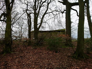
Going through Pavis wood there were several interesting structures that warranted further attention. This involved me climbing up a slope to get in to a very cramped area. It looked liked some sort of feeding station on two levels ? Decided to get out again as quick as possible as a bit claustrophobic.
The Ridgeway then crosses two large cow fields , thankfully minus the cows. I decided to stop at Uphill Farm just before Hale Wood.
It was getting murkier and there was a light drizzle. Not entirely sure of my route back I favoured caution on this occasion.
I retraced the route back to Hastoe and deviated slightly along a permissable footpath in what felt was roughly the right direction. Eventually after some half an hour I arrived in the village of Wigginton. It was tempting to pop into The Greyhound for a swifty as I was sweating up a bit. However I wasn't entirely sure where to go from here? I couldn't find the path to take me back over the A41. I had to do it the hard way by road. Mostly downhill but not quite the scenic canal walk I had envisaged! At least I ended up back at the car though


No comments:
Post a Comment