Monday, 28 June 2021

Gayton, Tiffield, Astcote and Eatcote Circular Walk


This walked was originally planned on the the one in 'Northamptonshire walks' (number 110) As is often the case things don't always go according to plan...

I realised on arrival in Gayton that I had forgotten to pack my trusty Ordnance Survey map, a cardinal sin indeed.I did have some abbreviated notes about the route we needed to follow though. There was the promise of seeing four Churches if we stuck closely to the details provided.

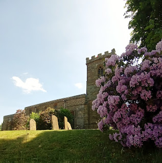
At least we saw one early on in Gayton, the Church of St Mary. very early church with a Norman tower incorporating a late Saxon door case and internally a Norman font. The main body of the church though dates from the 13th / 14th centuries.

We started off correctly, facing the church and walking down the Blisworth Road t leave the village. 


Old sheep has seen it all before

We leave the road after some old railway cottages. The path is quite overgrown, something we will see a lot of today. An old sheep sheltering by it's shed is quite unperturbed by our presence. There are some large Badger setts too that are potential leg breakers. 

Leaving the path we pick up the 'Northampton Round' to our right. To our left is the old railway bridge over steep drop to the valley below. 

We emerge by a lovely house 'Gayton Wilds' and continue on the Tiffield Road. We are supposed to see signs for a 'Pocket Park' anytime  now...one that never arrived. The road takes us all the way to Tiffield. We continue on to the village church of St John the Baptist. The church dates from the 13th century & quite possibly replaced a wooden Saxon church which existed on the site when the Domesday Book was written in 1086. As with the church in Gayton there is also a Commonwealth War Grave. 


'Gayton Wilds'

Although not particularly sunny it was very humid and quick pit stop was needed to take on some fluid.


We back track slightly turning left at Meadow Rise and picking up the track along a narrow passageway. We emerge along the Gayton Road, this is where it all started to go wrong. Not having a map didn't help the situation very much. 

My notes said we needed to head towards Caldecote going past a cattery? There was no sign of the stated cattery, not a miaow to be heard. I was trying to navigate from the 'Strava' app on the phone which didn't show footpaths. 

We did take a path towards Caldecote but we were continuously met with dead ends and no obvious paths. As you can see from the map there was a lot of 'zig zagging'  about. We had to climb over a barbed wire fence at one stage to get on a marked footpath. We resorted to heading towards the A5 Road as a bearing point. 


At last a decent clear footpath

Lost in the long grass under the power lines

Walking up the side of the A5 the famous Watling St wasn't as bad as I had anticipated. It is one of Britain's greatest arterial roads of the Roman and post-Roman periods. We take the first opportunity to take a footpath leading off though. Compared to the previous ones this is pure bliss, clearly marked and the Farmer has cleared of any crops. We are on our way to Astcote and back on track!

Passing the village Green and Red phone box we pass through some gates and stiles close to private properties. Unfortunately the footpaths deteriorate once again. Two fields of Oil Seed Rape is almost at head height. Thankfully the bright yellow flowers have now gone to seed. 

We emerge further up on the A5. The route crosses the A5 towards Cold Higham. We decide to miss this part because we are running behind schedule. Instead we follow Banbury Lane into Eastcote. Rather than more fields we walk up the hill into the village. We are back on the planned route again!

At the top of the hill, close to where you leave the village is a path on the left. We are on the way back to Gayton! 

We then pass through a farmyard and into large open fields and Gayton is visible on top of the hill in the distance.

There are some beautiful views around here, although my walking companion takes some convincing as fatigue has set in ....The uphill finish is not welcomed lets just say. 


It has certainly been a disjointed walk at times that is for sure. Although given the lack of a map I think we haven't done too badly all things considered.
In total a distance of some 11.60 miles. A walk I shall definitely try again in the future to try and put right where I went wrong this time hopefully?


Commonwealth War Graves


Tuesday, 22 June 2021

Owlswick and Longwick (Swans Way 10)

Our tenth leg of the Swans Way walk and a figure of eight route to optimise  time on the pathway. My walking Buddy had already warned me when he sent me the map that it didn't look a very interesting route. 'Lots of Fields' I think was the quote. 

Many times in the past we have had the same feeling only to proved quite wrong. Perhaps this will be another of those occasions? 

The weather was hardly inspiring either. Dull and overcast with the risk of showers was the forecast. Still, given the fact that it had rained solidly for two days, at least it was dry for now at least.

Given the experience earlier in the week when falling over the electric fence , I'm taking no chances today. Long trousers are the order of the day and a first aid kit is packed! Well a few  plasters and an antiseptic wipe should suffice.


We start near to the village of Owlswick, which is nothing more than a Hamlet really about 3 miles east of Thame and 4 miles south east of Aylesbury. The name appears in a document of about 1200 as Ulveswike, meaning the dairy farm of Ulf, which was a Danish personal name. The district is well to the south of the Danelaw (Where in Old England the laws of the Danes held sway)but a man of Danish origin may have come south and settled here.

One house seems to have a pony residing quite comfortably in their front garden .....St Peters Chapel in Owlswick is a pretty looking building. The present chapel was built in 1866, but there was probably a church in the village of Owlswick in the northern tip of the parish from around the time of the Norman Conquest. In its earliest days the chapel served as a village school as well as a place of worship, and a few traces of the school remain to this day including the bell that is still rung for services.


We are off and running 'Into the Great Wide Open' to quote the late great Tom Petty. Although we are soon  curtailed by a very overgrown footpath. Not only long grass and overgrown bushes, but very wet too. I'm thankful for the long trousers on this occasion. There is a lovely old derelict barn that puts me in mind of the 'Dads  Army' episode where 'Fraser' (John Laurie)rolls his eyes and spins the yarn of 'The Old empty barn'. There is the odd Owl pellet but nothing very exciting really.   

We arrive at the point we got too last time and complete the first part of the figure eight. As we make our way back have the Chiltern Hills in the distance.  

Everywhere give or take a bit of brown is a lush green colour. No wonder it symbolises nature and the natural world. In ancient mythology, green was used to reference the fertility of the earth as well as the fertility of women. Definitely a calming colour though, so I find it a bit strange that they say someone is 'Green with envy'. Not to mention if you are poorly and look a bit green. 

Not much wildlife to report today either I'm afraid.  A few Goldfinches and the odd Red Kite are as much as I can report. 

We continue towards the small village of Ilmer, there is a signpost for the Church that sounds interesting? Unfortunately our path doesn't go that far though. We pass under the railway bridge and The Swans Way veers off to the left. We do see in the far distance Whiteleaf Cross, a chalk figure carved on the Chiltern slope near Princes Risborough.It is cross shaped with a triangular base om Whiteleaf Hill. 

The date and origin of the cross are unknown. It was mentioned as an antiquity by Francis Wise in 1742, but no earlier reference has been found. The cross is not mentioned in any description of the area before 1700. Unfortunately I couldn't get a decent photo as it was so far in the distance sadly.  


Points of interest on this part of the walk have really been few and far between. As something of a last resort I am reduced to taking a couple of photos of Railway bridges.

 In total we have covered a distance of 9 miles and about half of it on The Swans Way.  


Thursday, 17 June 2021

The Stowes, Litchborough and Farthingstone Walk


A midweek day off and a nice relaxing solo walk in one of the most beautiful parts of the county. What could possibly go wrong? I'm in the picturesque village of 'Farthingstone' equidistant from both Daventry to the north west and Towcester to the south east. Parked up near to the church I set off in completely the wrong direction...... A helpful local lady put me back on track of a sorts. It involved taking a path that would essentially get me back to where I started from. Her assurances that it was a beautiful walk swayed me. What she hadn't told me was just how overgrown the path was.....In places it was impassable and I had to jump into the field of Broad Beans which was slightly easier. Another  extremely hot day and I was soon sweating and not to mention itching and suffering from stinging nettle rash. Into the bargain a large fly was also having a late breakfast on my arm. 


 It was with great relief that I found the footpath sign for the 'Macmillan Way'. This is where disaster was to strike again. Engrossed in reading my map I didn't see the electric fence .......... Not a pleasant experience slicing open my shin and getting quite a jolt into the bargain. Not carrying a First Aid kit I had to stem the bleeding with my handkerchief. Not been the best of start really has it?

It's a long steep climb through a corn field but the views back to  Farthingstone are worth it. I am now in the parish of Stowe Nine Churches, which incorporates Church Stowe and Upper Stowe. 

According to legend, the name derives from an incident involving St Michael's Church in Church Stowe. The site of the church was reputedly chosen by a supernatural spirit, who moved the building materials to a different location overnight for nine consecutive nights, so the builders eventually built the church in that location. 


The views from near the church are spectacular! 

All this excitement has made me hungry so It's time for a lunch stop . There is a nice bench in the shade b y the War Memorial. Unfortunately my hard boiled egg has become scrambled in the rucksack.. I empty out the worst and soon get joined by the chicken (pictured left) who soon finishes off the remains of the egg. That can't be right can it? That's cannibalism in my book surely?

Thankfully the path from Church Stowe to Upper Stowe is fairly straightforward. Except for my makeshift bandage deciding It no longer wants to stay on my leg. I emerge almost opposite the Church dedicated  to St James.

                
This is where the fun and games really started ... The footpath seemed to follow naturally across the road through a freshly cut field. Following down to the bottom all was good until there was literally nowhere to go. I retreated back up the field to where I started from. I managed to get into the next field which opened into another. However the edge had all been roughly ploughed which hardly made it inviting. I struggled through sweating profusely before giving up. Once more back up the hill into the village, this was getting silly , not to mention exhausting. 

I bumped in to a lady I actually knew! She told me how the footpath had not been maintained and was very badly signposted. If I persevered in a diagonal direction I should be able to get through to Litchborough.  I really could have done with a machete to be honest. It w of as not easy but fixed on a bearing in the distance I made it to Litchborough.

Looking back I can see the houses on the hill in the distance. I have a welcome sit down on a bench opposite the road back to Farthingstone. I'm tempted to take the safe route after all I've been through. However the original plan was to find the footpath. There is a nice pub in Litchborough unfortunately it would be another two hours before it would open at 4pm.

Off we go again!


Passing the Church of St Martin I managed to find The Knightley Way footpath. Part of which I walked from Fawsley to Preston Capes. I take time out to empty all the weeds and seeds from my boots which is quite pleasant. The path again is not entirely clear. At one point a large heard of cows became quite threatening and didn't back off even when I clapped my hands. Aware that on average 20 people are killed each year by cows kicking, or trampling I take very evasive action. This involved leaping over a five bar gate. It actually did me a favour as I was back on the Knightley Way from which I had strayed .   

From there onwards it was plain sailing back to Farthingstone. The highlight seeing a young Fox cub out on It's own. 


Not quite the relaxing walk that I had envisaged but still enjoyable though and a total of 11 miles exactly.


Arthingworth, Great Oxendon Tunnel and Braybrooke Walk


The first of two local walks, both completed in very hot and sunny conditions. The starting point is the village of Arthingworth, about 4 miles from Market Harborough  in the west of the county.

Parking close to the Church we set off to find the footpath to Great Oxendon. This was easier said than done as the signpost indicate two paths very close together. The first one we tried was completely overgrown so we had to backtrack. 

Taking the other path was much better and we even had a 'fly past' by the legendary 'Red Arrows'. The loose aim of this walk was to through the Gt Oxendon Railway tunnel on the old Northampton to Market Harborough railway line.We had previously done a walk that took in the tunnel at Kelmarsh which is a bit longer. 

The Oxendon tunnel is about 400 metres in distance and is dark, wet and the surface is quite uneven.


We leave the long and winding field and pick up the road to Great Oxendon. We are soon 'on top' of the tunnel as we are next to the air/ventilation shaft. Taking the path at the side of the field we get to the 'Brampton Valley Way'  and the tunnel entrance. Many of the train drivers giving them the unpleasant nickname "the rat-holes"because of the narrow bores or entry. Thankfully given all the recent good the tunnel is fairly dry.

After a slight 're-adjustment' at Waterloo Farm we are back on our way again leaving the 'BTW' picking up the footpath towards the village of Braybrooke. We won't actually go to the village but the church is a good bearing to follow in the distance. We join the Jurassic Way hoping to follow back to the road. However we meet a jogger coming towards us who tells us the path ahead is very overgrown and almost impassable. We are able to make a detour, taking a path back towards Great Oxendon. 


The highlight of this little diversion is a beautiful meadow and a pond filled with lilies and insects. A real oasis on a very warm day, the temptation was there to have a little paddle!

The low-point happened in the next field when my walking companion shouted out a warning. Three large dogs were in full flight charging towards me. Having recently been badly bitten by a dog this was not good news. I stood still, trying to show that I wasn't a threat. Thankfully they backed off  and retreated to the farm building they emerged  from.

Leaving a small paddock we come out by 'The George' Public House. At the crossroads we needed to head towards Braybrooke. We found the stile in the field on the right and it was back up to the 'Air Shaft' we saw earlier!

It's all fields right back to Arthingworth now after first encountering some over inquisitive cows.From the brow of the hill we can see Arthingworth in the distance & the path crosses the fields (with a few stiles) directly towards it. 


Been a tough walk in the heat but enjoyable non the less. Total distance of 9.7 miles.


Thursday, 10 June 2021

Cottesbrooke and Hollowell Circular walk

I'm back in Cottesbrooke, one of my favourite places in the County. Previously I have walked towards Maidwell, Lamport and up the steep Haselbech Hill. 

I had notice before a couple of footpaths in the opposite direction. Making a mental note at the time to explore at a later date. Well today is the day in question. 

Parking in the village we walk down past the post box in the wall, past the playing field and the bridge. Ignoring the first footpath sign and continuing a far as the Beck Dairy. This where I have always turned left before in the direction of Blueberry Lodge.  

Climbing over the style we are now on the Macmillan Way heading towards Creaton and Hollowell.


Leaving behind a tranquil Cottesbrooke, and It's chocolate box cottages we are amongst wide expanses of fields and hedgerows. The sun is beating down and it really is a perfect setting.It's a gradual climb as far as the village of Creaton. 

On a slight mound is the of St. Michael and All Angels in the Ecclesiastical Parish of Great Creaton. The building of local stone stands down from the A5199 Welford Road near the village green. The church and possibly the parish of may have been founded in the late eleventh or twelfth century. There is also  Commonwealth War Grave in the Churchyard.

Creaton also has a wonderful and typical old fashioned style village green .Surrounding the green are  a number of interesting buildings including the Manor House, built in 1604. Also overlooking the green are a terrace of Almshouses which were founded in 1825 and rebuilt in 1897.

We leave the church and the lovely views back towards Cottesbrooke and the Saxon Church of Brixworth in the distance. Crossing the A5199 we are soon back into fields and birdsong.  


Broad Beans seem to be the crop of choice, field after field of them. I'm quite partial to a few myself. Total peace and quiet, not even the rumble of distant traffic. No other walkers out this way either so perfect really. 

Eventually we leave the green fields and arrive at the road as expected. Taking a right we see a sign for a farm and then a bit further a track on the left. We take a further  right into 'Church Lane' that will take us into the village of Hollowell.


 Hollowell also provides the opportunity to call in on some 'Old friends' and some welcome refreshment on a very warm day. The name itself means 'hollow spring or stream and is mentioned in the Domesday survey of 1086. The village is well known for the Reservoir and it's 'Steam Fair' and 'Heavy' Horse Show'.  The event was first held in 1986 to raise funds to repair the village's church roof. I noticed a plaque on the lovely thatched bus shelter that was also funded by the show.  

We leave the village picking up a narrow track just before you reach the 'Pocket Park'. We are now heading back in the direction of Cottesbrooke. 


The wonderful views continue and are equally spectacular as the outward journey. Looking back as we arrive at the A5199 the water of the reservoir is shimmering in the far distance. 

We pick up the path again and follow through meadows of Buttercups. The style is well hidden  in the corner of the field! 

One more field to go and Cottesbrooke is in sight. The path takes us near to the Church and the entrance that we had passed earlier. A smashing little walk at exactly 7 miles!


The John Bunyan Trail (3) Hexton to Shillington

It's one of those 'shall we, shan't we sort of days. The weather has been poor all week and has worsened with the arrival of Sto...