Tuesday, 24 June 2025

Wimpole Hall Estate

After an eventful journey we finally arrive at the largest country estate in Cambridgeshire. A journey of road closures and diversions, mainly on the A428 kept us guessing if we would even make it to Arrington, near Royston to find Wimpole Hall. Judging by the car park it looks to be a popular place to visit too. A living working 3000 acre estate, guided by the seasons with an impressive mansion, parkland, gardens and rare breed farm all await. The site has been lived on and farmed for over 2000 years. Over the centuries, Wimpole has been owned by several families, and each has left its mark. Today though it is owned and managed by the National Trust. 

Our first port of call though is 'The Stable Block' Where a Tea Room and Gift Shop are located. Mrs A was in much need of Coffee after the fractious drive. There is also a well stocked second hand bookshop too. Looking at the map of the estate it was time to plane our next stop off after a successful re-fuel. The 'must see' is really the working farm and rare breed centre.

Built in 1794, Home Farm is the only in-hand farm of its kind in the National Trust. Unique to Wimpole Estate, it is a model for sustainable farming practices.There are 3 different breeds of Pig, Berkshire, Gloucester Old Spot and Oxford Sandy and Black. None of which seem particularly interested in their visitors. Far too busy constantly sniffing out nuggets of food within their straw bedding.This method discourages food hogging (Pun intended)and ensures every pig gets their fair share as well as encouraging their natural eating behaviours. It is a hot day and the aromas coming from the Pig Pens are pretty strong... The newly born Piglets are very cute though. The Great Barn is one of the few barns surviving from any period, designed by a known architect.The barn forms one side of the farmyard a cart shed and granary, stables and cow byres forming the other sides.

 
From Piggies to Heavy Horses, another of Britain's rare breeds. There are less than 1,500 breeding pairs in the UK.There are currently 5 Shire Horses at Wimpole; Queenie, Murphy, Jasper, Stanley and Lady. Many Foals have been raised at Wimpole Home Farm. They really are a beautiful breed, majestic gentle giants. The hope is that they will be introduced back to the field, ploughing and harrowing. 

There are plenty of animals too in the traditional farmyard, or out grazing in the parkland. There are also small black and white Bagot goats, and rare breeds of sheep out in the park or paddocks. Our next stopping off point is another 'must see' four-and-a-half-acre walled garden. constructed of red handmade bricks in the 1790s by Philip Yorke, 3rd Earl of Hardwicke, with no expense spared. Even the walls were heated to keep peaches warm during the spring frosts. It was in 1976 when the National Trust took over that the garden was restored to it's former glory after falling into disrepair. Restoration began in the early 1990s. With the rich herbaceous borders the garden is superb. The central area is split into four sections, a  good mix of soft fruit and flowers amongst the vegetables. 

The Pleasure Grounds connect the Walled Garden to Wimpole Hall. First planted by Robert Greening in the 1750s it was described in 1850 as having ‘picturesque, winding walks, leading a long way, admirably planted with groups and masses of the finest evergreens and deciduous trees'. On 22 October 1924, Elsie Kipling (2nd daughter of Rudyard Kipling) married George Bambridge (British Diplomat). In 1938 they bought Wimpole Hall. Over the centuries many notable architects have worked on the building. The building itself is Grade I listed., as is the estate itself.   

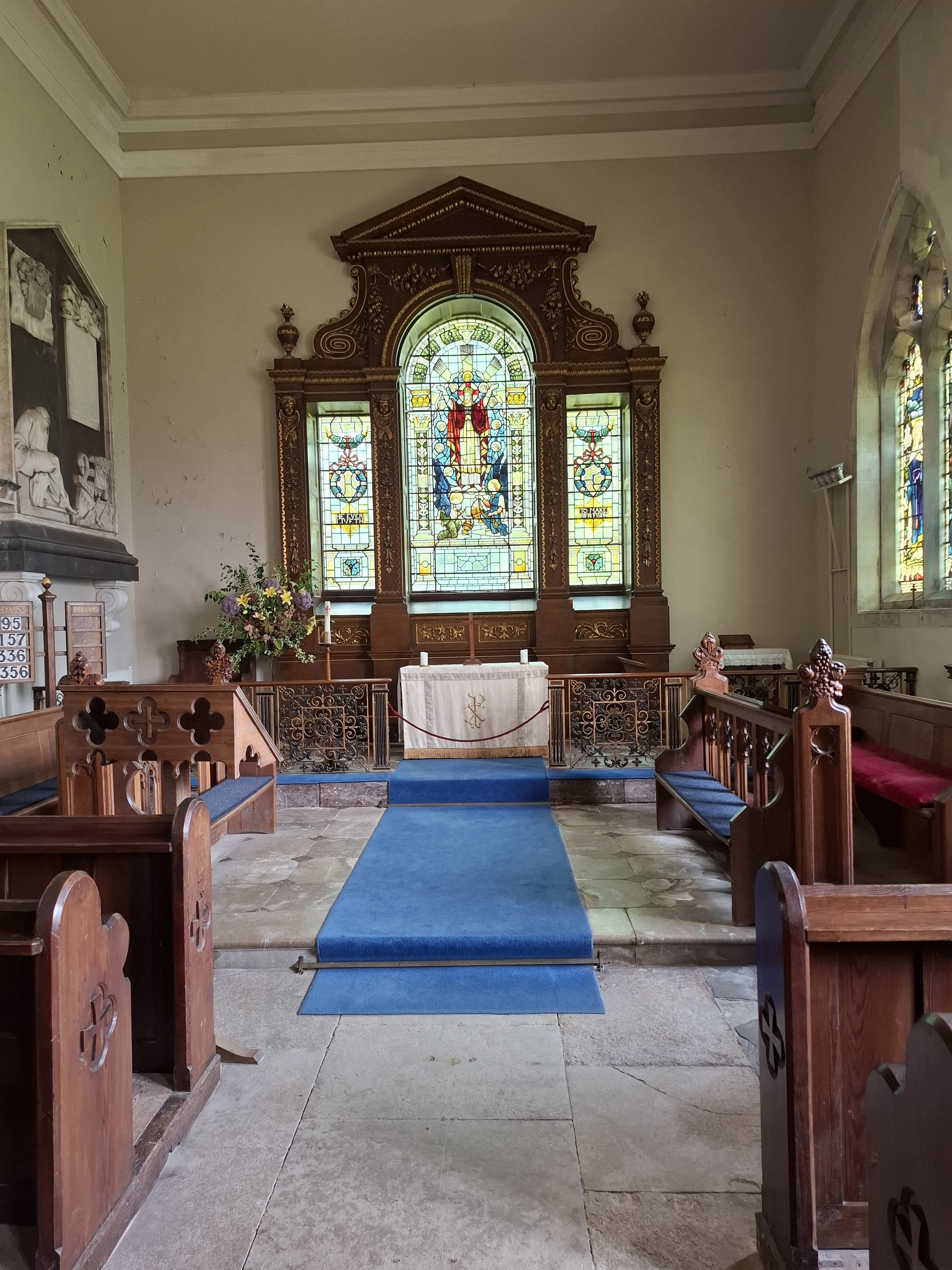
Close to the Hall is St Andrews Church, which replaced an earlier fourteenth century building that was largely demolished in 1748 as part of the landscaping of Wimpole park. It is owned by the Diocese of Ely and not the National Trust. It operates as a regular church, and is part of a group of five churches that make up the Benefice of Orwell in South Cambridgeshire.

It's a beautiful walk from the Hall across the meadows to the Serpentine Lakes. The bench next to the Chinese Bridge provides a wonderful place to relax and enjoy the wildlife. In a short space of time we saw a Kingfisher, Hobby, Heron, Dragonflies and the occasional jumping fish. We are on our way to the folly! As regular readers may know I have a real appreciation of a folly. In 2014 a major restoration project involving a cost of £430,000 was undertaken to restore, clean  and maintain the Grade II listed folly. The project went on to receive a prize at the Europa Nostra Awards 2016. 

The Tower is designed to resemble the ruins f a medieval castle. It has stood on the same spot for nearly 250 years.  The walls are made from a local chalky limestone called 'clunch' unfortunately it is very soft and vulnerable to damage.The ruins though are substantially built and stretch for two hundred feet in length, and include a four-storey Gothic Tower. Wimpole's Folly was featured in the TV series 'Slow Horses' which we were big fans of. season one, episode six, titled "Follies."  The folly was commissioned by Philip Yorke, 2nd Earl of Hardwicke. Sanderson Miller (the noted follies architect of the day)was responsible for the design in 1751and later built by Capability Brown in 1769. It is Grade II listed.

A fantastic walk covering around 7 miles in total, and we nearly didn't make it !Definitely a place that we will come back to in the future..


Monday, 9 June 2025

The John Bunyan Trail (10) Pavenham, Clapham & Bromham

The latest leg of the John Bunyan Trails sees us in the small village of Pavenham close to the River Great Ouse. We will be walking in a clockwise direction towards Oakley, about 1.9 miles away. We pick up the 'JB' straight away and are soon in open countryside. The weather forecast is good, with no rain expected. Perfect conditions for a good walk hopefully.  

Archie enjoying a run

Didn't really expect to see Highland Cattle on the walk today. Known as Bò Ghàidhealach in Scottish Gaelic, and Heilan coo in Scots, these iconic and extremely photogenic creatures, with their distinctive horns and long, woolly, wavy coats are at home on the BCN(Bedfordshire, Cambridgeshire & Northamptonshire) Nature Reserve. There is quite a 'fold' of them too. Although a group of cattle is usually called a herd, a group of Highland cattle is known as a ‘fold.’ They seem very friendly though, until you get a bit too close and the horn suddenly becomes a dangerous weapon. The cutest one of all though is the young one hunkering down on the floor.

At last, we get our first view of the River Great Ouse. We have been following the edge of it for some time, but it has been hidden behind trees and bushes. The longest British Rivers called 'Ouse'. The River has several sources in Northamptonshire and flows through, Bedfordshire, Cambridgeshire and Norfolk  on its way to 'The Wash'. It is the fifth longest river in the UK.Although there is some disagreement as to the actual length. Authorities quote between 160 miles and 143 miles.  We cross the river at Stafford Bridge as we approach the village of Oakley, some four miles north west of the county town of Bedford.It has a history stretching back to pre- medieval times, when the population was less than 100. Today the number of people living within the Parish boundary has risen to 2,500. We walk down to the river where an 'Egyptian Goose' is swimming with it's flock of young. Egyptian geese were introduced to Britain from Africa, and are actually a member of the 'Shelduck' family so aren't true Geese.   

Egyptian Geese

From Oakley we pass into the village of Clapham, previously known as Clopeham, has been an agricultural village since before the Norman Conquest. The Saxon church tower was used to look out for raiders who came up the river as far as The Ford. Talking of the Ford, my colleague who planned the route for today joked that he hoped there was a bridge to take us across! It is located near Green Lane and The Swan Public House. A rock and concrete crossing point to Bromham. Some members of the public tell us that it it only really used by Tractors. In Summer it is just about passable when the depth is about 2 feet. It gains several feet in winter and becomes fast flowing making it dangerous. There is a bit of a gathering at the Ford. Families enjoying the good weather having a paddle, a dog or two splashing around. However there is a distinct absence of a bridge of any form.....Thankfully I am wearing shorts and can roll them up a bit further. I would also need to remove boots and socks of course. My colleague is not quite so fortunate and has to remove his long trousers. 

Dog Rescue
Feet Drying


Safely across to Bromham

It is the most uncomfortable of walks across the Ford. As well as being uneven underfoot, the rocks are very sharp, not to mention slippery. A couple of times I nearly go over, which really isn't an option. It really is hard work and a case of taking small steps and keeping focused. Meanwhile my companion is finding things even more difficult trying to balance  a dog as well. Half way across he changes tactics and makes for the edge which is overgrown with nettles and bushes. I keep on going forward and the water gradually gets more shallow. We both make it across in safety and set about getting dried off and on our way to Bromham. 

Calmness is quickly resumed, helped by some lovely scenery passing 'Bromham Lake Nature Reserve' and 'Bromham Park'. Nearby is Bromham Mill, which we won't see on this walk. Bromham (Bruneham in Domesday) is probably the enclosed meadow on which the broom or the dyers' weed grew. Nothing of that nature is found today though. In fact there seem to have been at least a doze variations on the name between 1086 (Domesday Book) and 1227 when the modern day spelling was first recorded. We continue on our way towards Stevington through some lovely open countryside. I believe there will be some 'Bunyan' related interest too.      

Stevington Windmill

Stevington Windmill is an impressive postmill built in the 18th century and is the only complete windmill left in Bedfordshire.The whole body of the mill that houses the machinery is mounted on a single central vertical post.The windmill operated commercially, mostly grinding cattle feed, until 1939. It was purchased and restored in 1951 by Bedfordshire County Council. We could have walked up to the Windmill, my Hernia was in full swing though and I didn't fancy any extra yards thank you very much.

Stevington Cross

Arriving into Stevington village and at the crossroads we find 'Stevington Cross'. A stone cross dating from the 14th Century. This would have been a preaching cross, and used before places had a church. Just the sort of place that a travelling Priest would use to hold a service. There is a legend that John Bunyan preached at Stevington cross; this has sprung from his words in Pilgrim's Progress: "He ran till he came to a Place somewhat ascending and upon that place stood a Cross, and a little below in the bottom, a Sepulchre". Furthermore it is thought to have inspired his writing about Christian's burden falling from his back, and rolling down into the holy sepulchre. Too much, perhaps, can be made of every part of the landscape of the book having a Bedfordshire counterpart and, certainly, there is no evidence of his ever having visited Stevington. His church in Bedford had links with the West End Baptist Meeting but that is all. We continue down 'Church Road in search of the 'Holy Well'. We actually thought that we might have missed it and checked with a couple of locals. They confirmed that the Well was to the rear of the church of St Mary the Virgin.

church of St Mary the Virgin.

 St Mary’s Church has been the village centre of worship since the 11th century when the original stone tower was built.  There was an earlier wooden watch-tower in the 9th century on the site.  Additions have, of course, been added over the centuries. overlooking the River Great Ouse, it is a beautiful spot for any visitor with its churchyard a wildlife haven of biodiversity.

The Holy Well Stevington

The spring issues from limestone rock underneath the church and the archway is incorporated into the wall of the church. It is debatable as to whether the well is considered holy because it flows from under the church, or whether the church was built on this site because of the well? This ancient spring was thought to heal eyes and was used by pilgrims for centuries.The 'Holy Well' may also have been Bunyan's 'sepulchre'?

We are also now on the 'Ouse Valley Way' a 150-mile (240 km) footpath starting from Syresham in Northamptonshire to 'The Wash' in Kings Lynn. A source-to-sea route on one of England's longest rivers. We are nearing the end on this particular walk though. We pass through a series of 'Kissing Gates' before arriving by the river once more. We are warned by a sign that the ground is very boggy. Given the lack f rain in May and in to June they were surprisingly boggy. This is as an area shown on the map as 'Osier Holts'. Where historically willows were planted and coppiced for their flexible twigs and used for basket making and other crafts. The marshy fringes of rivers, especially those which were often flooded  were the most common locations for osier beds.Once a significant industry in Great Britain until the early 20th Century, when industrial machinery and the import of cheaper materials made them unprofitable and commercially unviable.We follow the direction of the river through woodland back into Mill Lane back at Pavenham. It has been an interesting and a times exciting walk . A walk of 10.57 miles This will be the last 'proper walk' for a while as two lots of surgery loom large on the horizon. Hope to be back stronger than ever!


Wimpole Hall Estate

After an eventful journey we finally arrive at the largest country estate in Cambridgeshire. A journey of road closures and diversions, main...